Municipal511
Publicly available mapping system to centralize planning and communication of traffic disruptions
Easy-to-learn, easy-to-use road information management service. An intuitive dashboard and map view, communicating closures and distributing data that is faster and easier than sending emails.

"This new system improves the overall travel experience across our territory."
With DriveNWT, we are transforming the way residents and industry access travel information in the Northwest Territories. This new system empowers travelers to make informed decisions and improves the overall travel experience across our territory.
Minister of Infrastructure of the Government of Northwest Territories
"The Municipal511 system is surpassing any expectations that I
ever had."
Now that I have added all my firefighters to the system to receive updates, it allows
them to keep abreast of the latest road closures. It gives them an advanced warning that in the event we had to respond to any emergency calls the roads which were closed. They have the information to plan alternate routes to not only get to the fire hall, but the routes to take to respond to an emergency scene. This information system is invaluable for members of the St. Mary's Fire Department.
Fire Department Chief of Town of St. Mary's
"The two-way integration with Waze, and other data feeds into Municipal 511, provides the county a true picture of what is happening in our communities every day."
This is especially critical during emergencies like snowstorms, ice storms, tornadoes and severe thunderstorms. Leveraging the Municipal 511 platform is a great opportunity for the municipalities of Oxford County to work together to improve efficiency, provide better service to our communities and harness technology in a very cost-effective fashion.
Emergency Coordinator at Oxford County
"Five stars for quality, ease of use, customer support, and features—highly recommended!"
Municipal511 is incredibly easy to use, especially when editing issues like extending dates. The 'last description' box in Entry Details is a great feature. I appreciate the email notifications for overdue issues (i.e. long-term construction and need to extend dates).
Public Works Operations Assistant of Municipality of North Perth
"It’s been invaluable for situational awareness, especially for our Paramedic Duty Commanders."
Municipal511 is a fantastic product that brings all information together in one place, with multiple layers that are incredibly useful. We've even used it to create emergency management exercise layers to simulate disaster events. It has also streamlined how we manage road closures—no more stacks of faxed notices. While it takes some effort to get everyone on board initially, the benefits are well worth it. Highly recommended!
Acting Commander of Renfrew County Emergency Services
"10/10 would recommend!"
After using Municipal511 for over two years, I can confidently say that its simplicity and extensive range make it an outstanding tool. It's been well received by agencies and emergency services. The quality, ease of use, customer support, and features are all top-notch!
Capital Projects Manager at County of Peterborough
"The thing that makes this program so nice is its integration with the routing apps that people are using already."
Providing wider access to the information through the online system could reduce the amount of traffic ending up in county detours if drivers are alerted in time to take alternative routes, which would be safer for our workers and would help traffic congestion.
County General Manager of Infrastructure and Development at Lambton County
"The user-friendly setup makes it simple to find what you need."
I appreciate how easy it is to edit pre-existing closures or road work with minimal difficulty. While I'm still learning the program, my overall experience has been good. The Support Staff are very nice and proactive in reaching out if there are any concerns or updates.
Town of Erin
“Seconds can be critical for emergency responders.”
Prior to the implementation of Municipal511 for road closures and construction, slower manual processes meant emergency crews could be unaware of construction or closures on their route. Now using Municipal511, county closures will go directly into computers in each paramedic vehicle.
Chief of Paramedic Services at Oxford County
"The use of technology to help your residents live better and safer lives."
The project could help Sarnia-Lambton’s bid to reach the top of the list with the Intelligent Community Forum (ICF). This is one of the types of projects that are strongly encouraged and looked on favourably by the ICF – the use of technology to help your residents live better and safer lives.
County CAO at Lambton County
Municipal511 clients in North America
...and many more!
Effortlessly share traffic disruption information
Municipal511 is a highly accessible web application, easily reachable from any device with internet connectivity. This feature eliminates the need for specialized IT support or frequent application updates, ensuring a smooth and consistent user experience.
The platform's design focuses on user convenience, fostering a community where users can effortlessly share information and receive support from the service provider.
Map-Centric Approach
The service adopts a map-centric approach, integrating all regional road information into one comprehensive map. This unified map, which includes local, regional, and provincial roads, is not only an essential tool for thorough visualization but also features in various municipal and regional government websites. It allows users to switch between different base map views like Google Maps, satellite, and terrain, and customize their view with various layers and overlays, catering to diverse needs and preferences.
Customization and Convenience
The service adopts a map-centric approach, integrating all regional road information into one comprehensive map. This unified map, which includes local, regional, and provincial roads, is not only an essential tool for thorough visualization but also features in various municipal and regional government websites. It allows users to switch between different base map views like Google Maps, satellite, and terrain, and customize their view with various layers and overlays, catering to diverse needs and preferences.
Key Outcomes:
Effortlessly Share Traffic Disruption Information
Municipal511 is a highly accessible web application, easily reachable from any device with internet connectivity. This eliminates the need for specialized IT support or frequent application updates, ensuring a smooth and consistent user experience.
Our Approach, Your Results
Municipal511 provides a detailed map presentation, centralizing road information for travelers, road authorities and emergency services. This approach simplifies data sharing, traditionally managed separately by each road authority, enhancing user convenience and promoting a community of effortless information exchange.

Unified Mapping Solutions for Precise Traffic Information
Municipal511 combines comprehensive road information, from local to private paths, into a unified, detailed map, offering advanced mapping for accurate issue reporting. It allows for diverse base map views and customizable layers, enabling users to precisely identify locations, describe traffic impacts, and employ visual elements like points and polygons for enhanced clarity.

Customization and Convenience
Municipal511 allows users to save specific map views and generate custom reports. It offers language options and measurement unit preferences, catering to local requirements. This customization enhances the user experience, making the platform adaptable and easy to use.

Notifications and Communication
The platform offers real-time, push email notifications and scheduled notifications for effective communication. Users can create and distribute complete messages electronically, ensuring timely information reaches stakeholders. A robust contact management system supports individual and group notifications.

Public Accessibility
Municipal511’s public map can be integrated directly into municipal websites, providing the public with comprehensive road information. Customizable iFrame links allow for tailored map presentations on various sites, enhancing public awareness and safety.

Seamless Integration for Improved Road Information Management
Municipal511 integrates with Permit Central and third-party apps like Waze, Here, and Emergency Systems, along with GIS. This ensures wide distribution and current road information, streamlining government permitting processes and enabling early conflict identification for permits, improving time and administrative efficiency.

More than Just Road Information!
Municipal511 can support other use cases with private custom layers, which can be used to track just about anything that can be plotted on a map. For example, to track homeless encampments, snowplows and other equipment, and more.
Elevate Your Road Information Management
Experience the efficiency of Municipal511. Discover how our intuitive, map-based service can streamline your road information distribution and improve communication with just a few clicks. Fill out the form, and our team will connect with you for a discovery call to dive into the benefits tailored for your needs.
Start your journey to smarter road management now.
Project Highlights
We've done some interesting projects over the years with customers of all sizes in North America. Below are some examples of what we can do.
If you want to learn more about a project, or if you have a project in mind, please Contact Us.

DriveNWT Traveller Information System
Government of the Northwest Territories
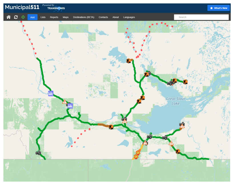
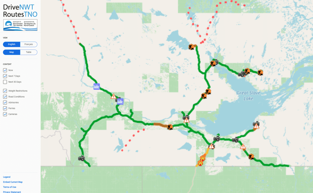
Transnomis, in collaboration with the Government of the Northwest Territories, has launched DriveNWT, a modern traveler information system. Built on the Municipal511 platform, it delivers real-time road updates, enhancing safety and travel across the region.

Publicizing Public Works Permit Data
Long Beach, California
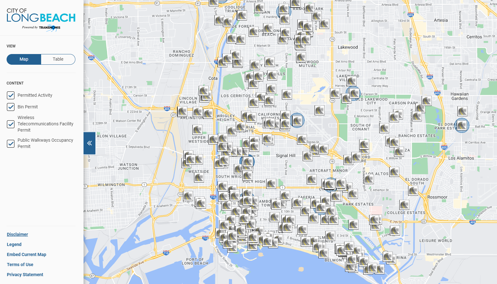
The Municipal511 Long Beach project streamlines road condition management and permitting by displaying real-time information on closures, construction activities, and public works permits. This GIS-based platform enhances transparency by allowing stakeholders to access up-to-date permit data, improving communication between city departments and aiding both residents and businesses in navigating disruptions effectively.


